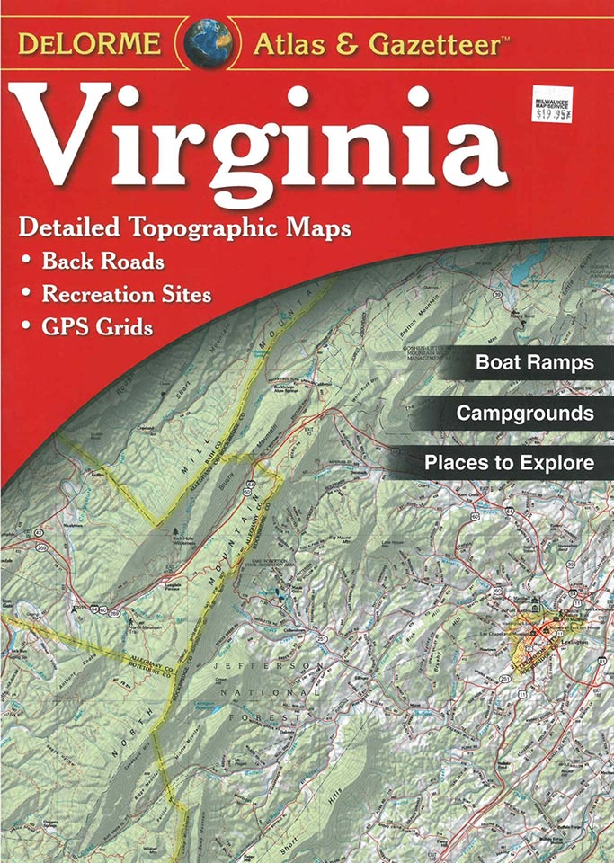
Delorme Atlas and Gazetteer

There is a Delorme Atlas and Gazetteer for every state in the U.S. and they cost around $20 each. These are outstanding tools for developing plans for your adventures. They include a series of topographic maps mostly 1:150,000 (2.4 miles per inch), although scales vary, with 300 foot contours. They are not as topographically detailed as the U.S.G.S. 1:24000 series that you can download free. They do however include many more trails and points of interest than the USGS maps. Having a whole set of maps in a book to carry with you when you travel makes it easy to plan an adventure wherever you might be.
In addition to the maps, these books include:
 an index of towns
- short descriptions of unique natural features
- a list of campgrounds
- a list of parks, forests and wilderness areas
- short descriptions of oar and paddle trips
- a list bicycle routes
- a list of hunting areas
- a list of historic sites and museums
- a list of scenic drives and back country byways
- a list of boat ramps and fishing
- ski areas
- other points of interest
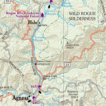
All of the sites in these lists are keyed to to the maps so you can easily find the amenities you want in your area.
Last March, Garmin, a manufacturer of GPS units that have maps built into them, acquired Delorme, the maker of these atlases. At that time Garmin said it would keep most of Delorme’s employees but we wondered whether they would continue to publish the atlases. It wasn’t clear whether Garmin would look at paper maps as competition with their GPS units and do away with the paper-based cartographic work at Delorme.
Earlier this week, Garmin put our concerns to rest when Ted Gartner, director of corporate communications for Garmin, said: “As a part of the acquisition earlier this year and subsequent integration efforts, Garmin recently completed its analysis of DeLorme’s Atlas & Gazetteer business. We have concluded that these venerated, highly respected products will not only remain as a part of Garmin’s offering, but will continue to be enhanced in the coming months and years.”
This seems like a good idea to us. Not only because we like the paper maps, but also because the cartographers that Garmin acquired with Delorme can continue to keep the paper maps up to date and digital versions of the maps can also be used in Garmin’s GPS products.
DeLorme paper atlases continue to be in strong demand, even as digital alternatives continue to proliferate, because many people are discovering there is no substitute for a traditional atlas in making the most of their family road trip, hunting adventure, relocation planning or business travels. DeLorme Atlas & Gazetteers are unique in that they combine the latest digital technology with human editors to verify travel information and map details, ensuring clarity and accuracy. – Garmin Ltd.
The atlases are widely available at stores in the U.S. and various online sources including:
Great Products From Great Merchants
Recent Posts
Get Blog Posts by eMail
Deals of the Day – Don’t wait!
Gear Up!
Become a Patron

About Our Merchant Sponsors
![]() Subscribe | Follow Us:
Subscribe | Follow Us: ![]()
![]() | Share:
| Share: ![]()
![]()
![]()
Add this post to your Flipboard Magazine: Add to Flipboard Magazine.
Watch Our Video Podcast Series on iTunes or see our videos on YouTube.
Privacy Policy - Privacy Tools - Terms and Conditions - Copyright and Trademark Statement
©2018 Global Creations LLC - All Rights Reserved.
Leave a Reply